NOAA
<- Return to all blogs
-
Building Conversational Interfaces for Querying and Analyzing Geospatial Data
NOAA maintains thousands of datasets of various kinds (remote sensing, in-situ, derived etc.) across multiple domains (climate, weather, ecology, etc.) consumed by a wide variety of users (scientists, engineers, urban planners, etc.), but discovering, accessing, and using these datasets remains a significant challenge. Recent developments in cloud-native geospatial technologies and standards have made geospatial data…
-
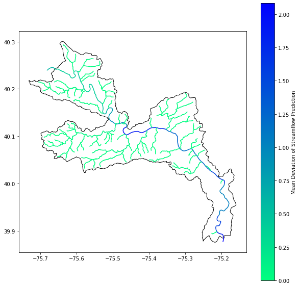
Using Kerchunk to make NOAA’s National Water Model Dataset more accessible
In this blog, we discuss our experience using Kerchunk to improve access times to short-range streamflow predictions generated by NOAA’s National Water Model Predictions Dataset, achieving a speedup of 4 times, using 16 times less memory.