AI
<- Return to all blogs
-
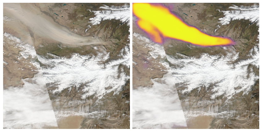
Segmenting Sandstorms in Satellite Imagery
In this blog, we walk through our approach to segmenting sandstorms in satellite imagery, evaluate the quality of our results, and compare them against existing solutions.
-
Segmenting Sandstorms in Satellite Imagery
In this blog, we walk through our approach to segmenting sandstorms in satellite imagery, evaluate the quality of our results, and compare them against existing solutions.
-
Emerging trends in geospatial: May 2024
In this post, we highlight a few of the trends in geospatial our team noticed at SatSummit, and we’re outlining how we plan to integrate these trends into our work.

-
Natural Language Geocoding
We discuss how natural language geocoding is changing the landscape of data analysis, making it more accessible and efficient.