All blog posts
<- View categories
-

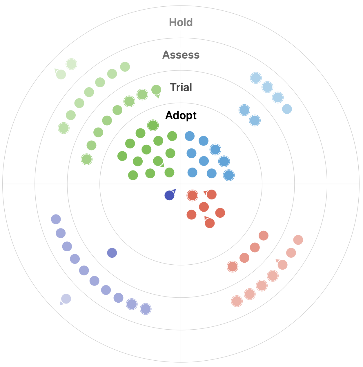
Updating our Geospatial Technology Radar for 2024
We introduce the second iteration of our geospatial technology radar, which is designed as a resource for the community to outline impactful technologies in the space.
-
Updating our Geospatial Technology Radar for 2024
We introduce the second iteration of our geospatial technology radar, which is designed as a resource for the community to outline impactful technologies in the space.
-
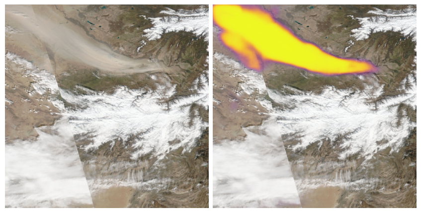
Segmenting Sandstorms in Satellite Imagery
In this blog, we walk through our approach to segmenting sandstorms in satellite imagery, evaluate the quality of our results, and compare them against existing solutions.
-
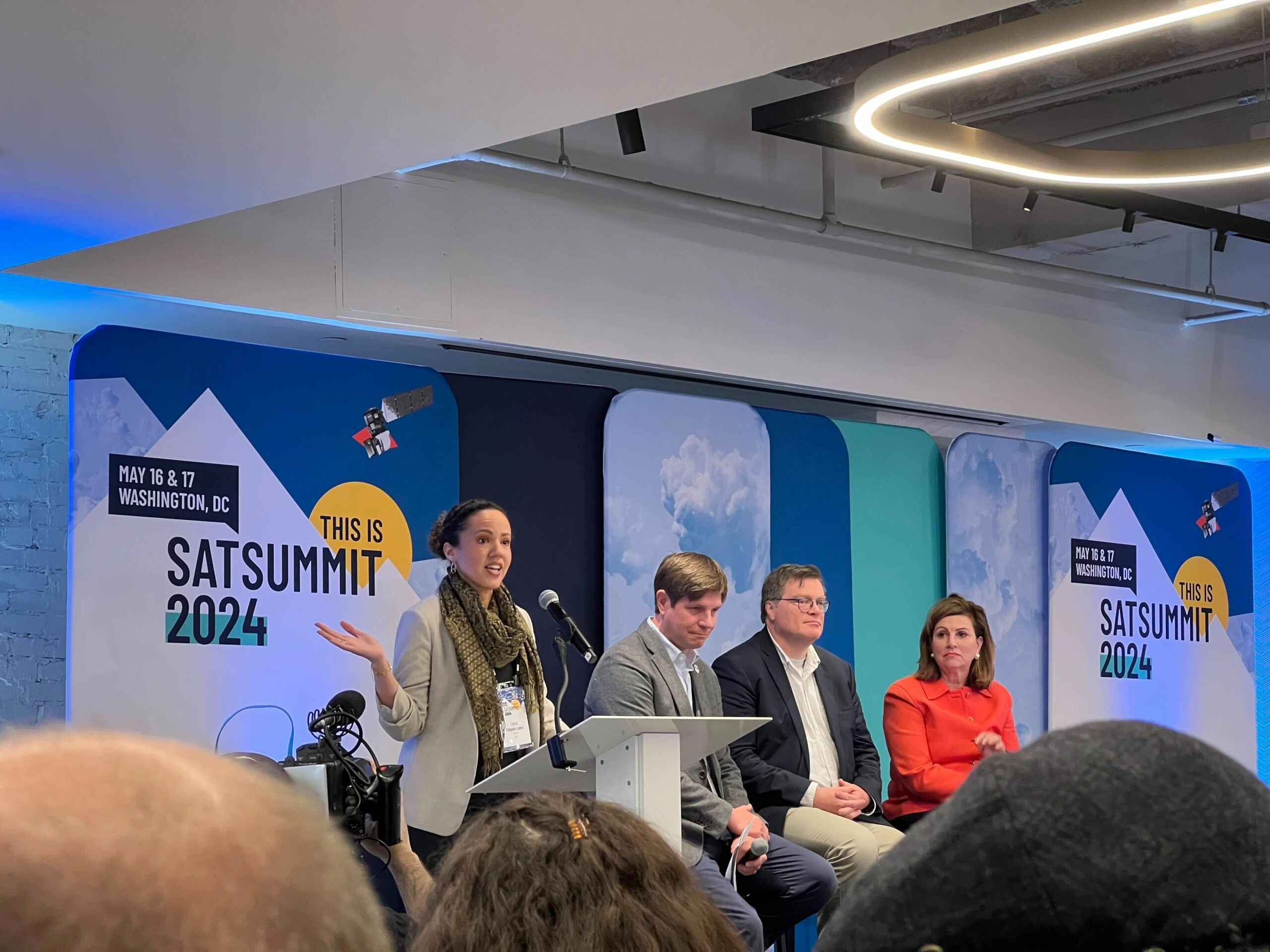
Emerging trends in geospatial: May 2024
In this post, we highlight a few of the trends in geospatial our team noticed at SatSummit, and we’re outlining how we plan to integrate these trends into our work.
-
Natural Language Geocoding
We discuss how natural language geocoding is changing the landscape of data analysis, making it more accessible and efficient.
-
Tasking Sprint #3 Recap
The Berlin tasking sprint was a significant step forward in the documentation and details of the specification, while we also developed the foundation of an ecosystem to prove out STAPI.
-
Using Generative AI in AWS for the Federal Government
In this blog, we detail how to get started with Generative AI in your existing Federal Government cloud accounts.
-
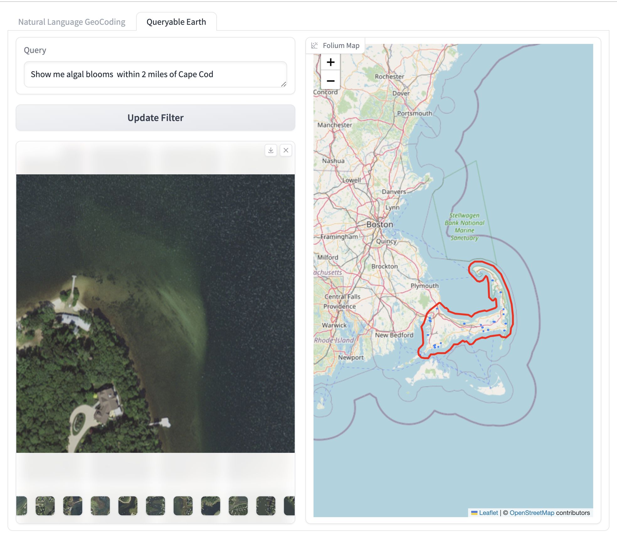
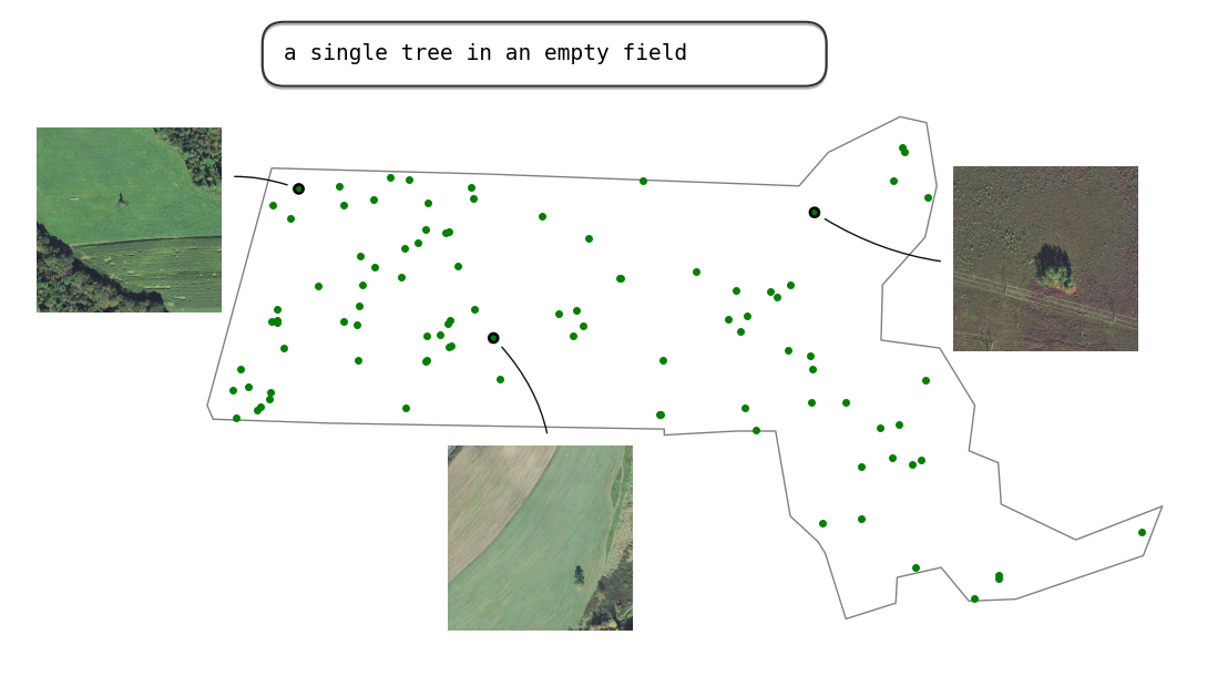
Building a queryable Earth with vision-language foundation models
We take a close look at two such remarkable VLMs that have come out in the past few months and, using these models, we build a prototype “queryable Earth” functionality that allows retrieving images along with their geolocations using text queries over a large geographical area.
-
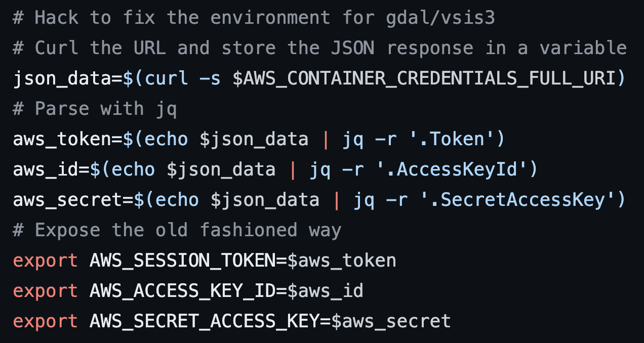
Using GDAL with EMR-serverless for large-scale data processing
In this blog, we discuss the history of modern big data and outline how we use GDAL-EMR-serverless for large-scale data processing.
-
Climate Unit Director Profile:В Catherine Oldershaw
In this blog series, we’re profiling the new directors of our business units to provide a full picture of how we’re gearing up to make the biggest possible impact in 2024 beginning with this feature of Catherine Oldershaw, our Climate Unit Director.

-
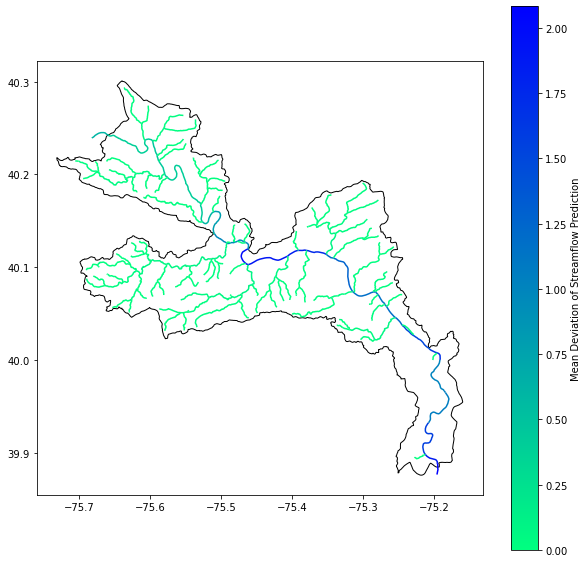
Using Kerchunk to make NOAA’s National Water Model Dataset more accessible
In this blog, we discuss our experience using Kerchunk to improve access times to short-range streamflow predictions generated by NOAA’s National Water Model Predictions Dataset, achieving a speedup of 4 times, using 16 times less memory.